|
|
|||||||||||||||||||||||||||||||
Let us show you around and tell you about this place
|
|||||||||||||||||||||||||||||||
|
|
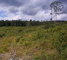
Farmland at the turn of the 20th century, Moulton Hill grew until recently into mature forest. In 1995, it was harvested for lumber, "clear-cut" by a logging company who used less than "managed techniques" to harvest lumber, leaving a disrespectfully scarred landscape. Yet, out of that trepidation emerges a thriving young forest, scientifically known as an early successional forest. In 1997, the land was acquired by private owners for ecological restoration and recreation.
The Town of LymanThe town of Lyman, New Hampshire (pop. 200) is located about 20 miles west of Cannon Mountain and Franconia, NH. This beautiful country was mostly farmland throughout the 1800's. After the Civil War, the area began to be abandoned as the population shifted to new urban areas and manufacturing centers. Today, the area is largely mature forestland. The town offices are housed in an old farmhouse, built in 1865. There's a country store, the old Lyman Bible Church, and, well, that's about it.
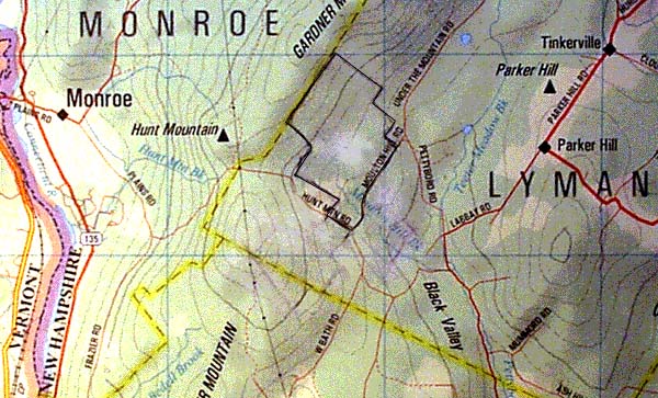
Boundaries
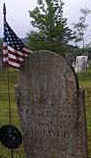
The Moulton Hill Forest consists of 575 acres, or 9/10th of a square mile, bounded by 6050 feet of graded town road, 7647 feet of old stone wall, and 9728 feet of old barbed wire (total perimeter 4.44 miles). Today, the boundaries are easy to see because the recent clear-cutting marks the edge of abutting properties where old growth trees remain standing. There are additional stone walls contained within the perimeter, marking abandoned farm boundaries. The Lyman Moulton Hill Cemetery sits on the southwest edge of the property, reveals history of the area, with tombstones dating back to the early 1800's.
Interior FeaturesWith a variety of terrain, there are three large hills reaching elevations of 1900 feet, rising 800 feet above the low elevation of 1100 feet. Moulton Hill Brook, a perennial running stream, originates on these hills and flows due south through the center of the property, merges into the and eventually empties into the Connecticut River at the Vermont border. There are several beaver ponds with significant beaver damns and lodge structures. Beavers have been sighted.
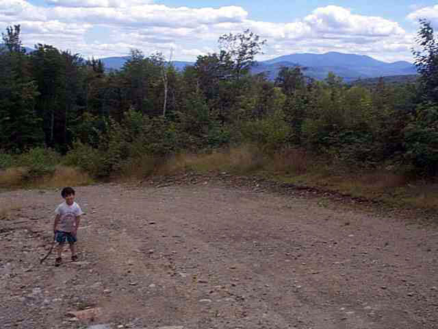
A main access road enters the property on Moulton Hill Road, adjacent to the cemetery, and roughly follows the brook north for about one mile to the center of the property. However, at about the 6/10th mile mark, the road is washed out where it crosses the brook and the culvert needs to be replaced. There are two major logging landings, each about two acres, one near the entrance, and the other past the washed out culvert, up a hill, nestled at the foot of the steep hills.
Surrounding AreasVisible are the nearby rolling hills of Lyman and Bath including the old steepled Lyman Bible Church on Parker Hill Road, in plain view about 3 miles due east. The Connecticut River and the Vermont Border are just 3 miles due west, though not visible past Hunt Mountain (2000') and Garner Mountain.
About 15 miles to the east and southeast begin the White Mountain National Forest (764,000 acres) which extend east across the state into Maine. You can see the peak of Mt. Mooslauke (4810') about twenty miles to the southeast. Due east, on a clear day, Mt. Washington (6288') is visible at a distance of 35 miles.
Deeded History of the Land
|
Related Stories
------- Coming Soon
|
|||||||||||||||||||||||||||||
Sequential surf: |
|||||||||||||||||||||||||||||||